Construction and renovation projects need accurate information from the start. Relying on old drawings or manual measurements often leads to mistakes. These errors can cause delays, budget issues, or rework on-site.
Scan to BIM Services has become a trusted method to avoid these problems. It helps teams capture real site conditions with high accuracy. This data is then used to create detailed digital models.
More professionals are now using Scan to BIM to plan better, reduce surprises, and improve coordination. It supports faster decisions and smoother project delivery across all stages of the building lifecycle.
Let’s take a closer look at what Scan to BIM is and how it works.
What is Scan to BIM?
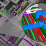
Scan to BIM is the process of using 3D laser scanning technology to capture precise measurements of a physical space and converting this data into a digital Building Information Model (BIM). This method allows for the creation of accurate and detailed 3D representations of existing buildings or sites, which can be used for design, construction, and facility management purposes.
The process begins with a 3D laser scanner capturing millions of data points from the physical environment, forming a point cloud. This point cloud is then imported into BIM software to develop a comprehensive digital model that reflects the real-world conditions of the scanned area.
Reference:
- https://www.autodesk.com/industry/land-development/scan-to-bim
- https://matterport.com/blog/scan-to-bim
What is laser scanning in Scan to BIM?
Laser scanning is a method used to collect accurate data from physical spaces. It works by using laser beams to measure distances between the scanner and objects in the environment. The result is a large set of data points, known as a point cloud.
There are different types of laser scanners:
- Terrestrial laser scanners – placed on a tripod and used for detailed, fixed-position scanning.
- Mobile laser scanners – mounted on moving platforms like carts or vehicles, useful for large areas.
- Handheld scanners – portable devices for small or hard-to-reach spaces.
- Drone-mounted scanners – used for scanning rooftops or wide outdoor spaces.
Each scanner collects millions of data points in a short time. These points represent the shape, size, and position of surfaces and objects. The data is used to create a 3D view of the scanned area. This forms the base for the BIM model.
Pro Tip
Use scan targets and reference markers during scanning to simplify registration and reduce alignment errors.
How are As-Built Details captured?
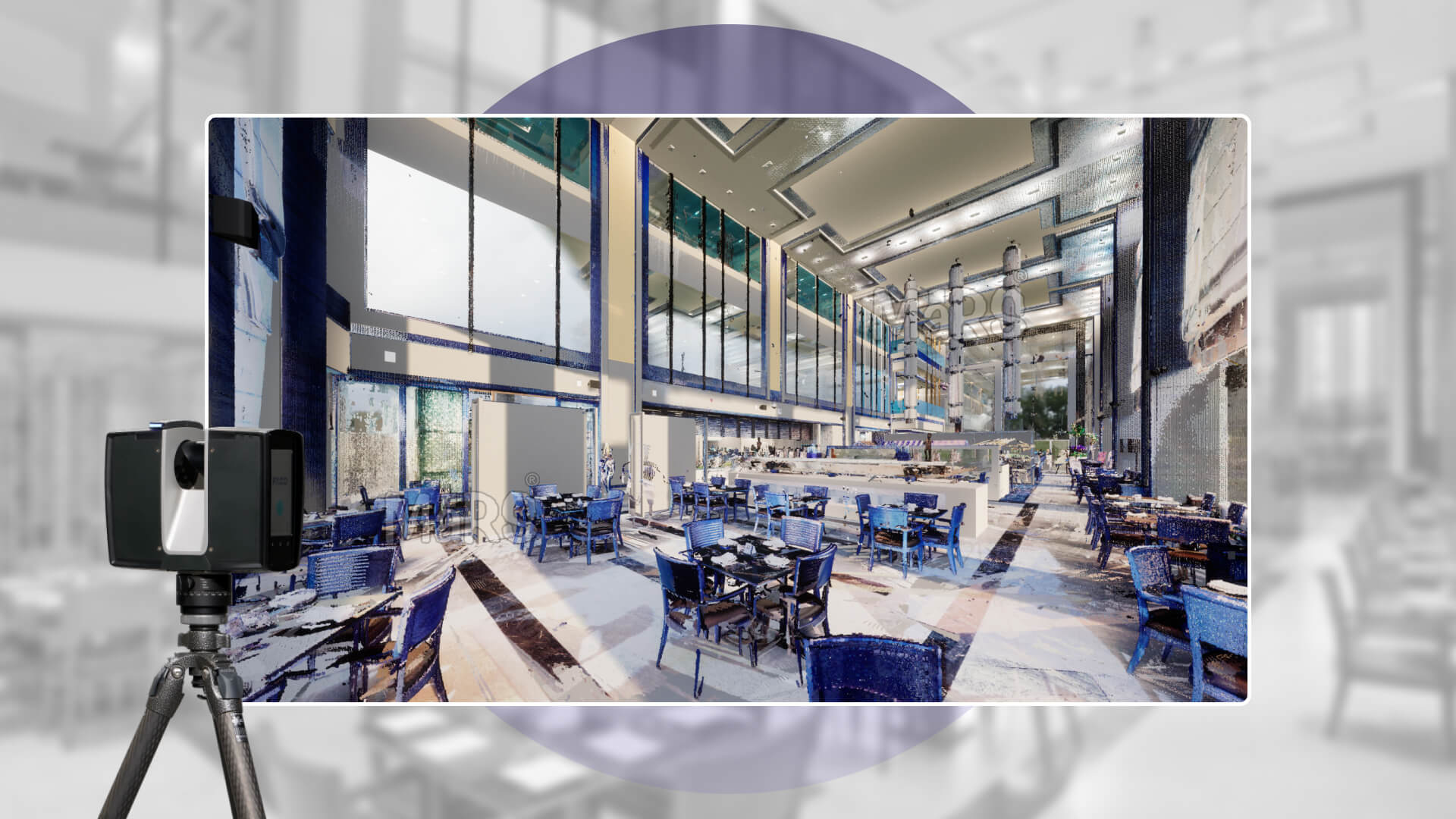
Capturing as-built details starts with a site visit. The scanning team places the laser scanner in multiple positions. This helps cover all visible parts of the space. The scanner collects data in the form of point clouds.
After scanning, the data from all positions is combined. This step is called point cloud registration. It aligns the individual scans into a single, accurate 3D dataset.
The registered point cloud reflects the exact state of the building or site. It includes walls, floors, ceilings, pipes, and even small objects. This data is then used to build the BIM model in software like Revit.
This method is much faster and more accurate than manual measurements. It reduces errors and ensures that the digital model matches the real-world conditions.
What is a BIM Model?
A BIM model is a digital version of a physical building or space. It is more than just a 3D model. It contains detailed information about the building’s parts, materials, and systems.
Each element in a BIM model carries data. For example, a wall in the model will include its height, thickness, material type, and fire rating. Pipes, doors, windows, and equipment also include technical information. This helps teams understand how everything fits and works together.
Pro Tip
Always define element categories and parameters early. This helps maintain data consistency across all disciplines.
Building Information Modeling is used across many stages of a building’s life. These include planning, design, construction, and maintenance. Because the model holds real data, it supports better decisions.
BIM models are created using software like Autodesk Revit, Archicad, or Bentley. These tools help link geometry with data. Teams can view, update, or check building elements in real-time.
With BIM, all project members can work from the same model. Architects, engineers, contractors, and facility managers use it to avoid errors and delays. The model becomes a shared source of truth for the whole project.
How Scan to BIM works?
Scan to BIM works by capturing real-world building conditions using laser scanning. The scanner collects millions of data points, which form a digital point cloud. This point cloud shows the exact shape and size of the physical space.
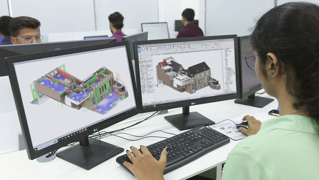
The point cloud is then brought into BIM software like Revit. Modelers trace over the data to create a 3D model. This model includes architectural, structural, or MEP elements, depending on the project. The goal is to match the model closely with the scanned site. After quality checks, the model is ready for use in planning, renovation, or facility management.
Example
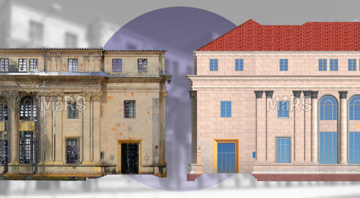
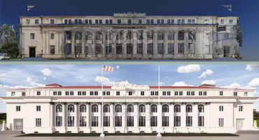
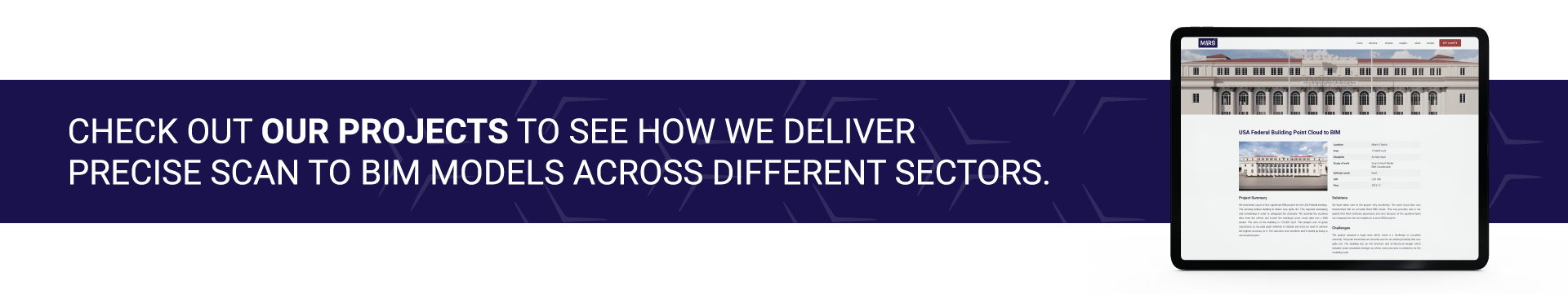
The David W. Dyer Federal Building and United States Courthouse in Miami was scanned as part of its restoration and conversion into an educational facility for Miami Dade College. The laser scanning captured accurate measurements of the 162,250 sq.ft. structure. This included detailed architectural elements and structural features.
The team at MaRS BIM Solutions converted this data into a detailed Revit model. The model was used for planning the building’s renovation into classrooms, event spaces, libraries, and offices. The team also coordinated structural changes while preserving the building’s historic design. The final BIM model was accurate, clean, and ready for design coordination.
Check this blog to understand the whole process of Scan to BIM.
Other Deliverables from the 3D Model
A Scan to BIM model is not limited to 3D viewing. It holds detailed data that can be used to create many project deliverables. These outputs support design, planning, coordination, and building operations. Different teams can use these based on their needs. These deliverables make the model useful across the entire building lifecycle.
- 2D Drawings – Floor plans, elevations, sections, and ceiling plans can be extracted for use in construction and documentation.
- Schedules – Lists of building elements like doors, windows, and fixtures can be generated for cost estimates and planning.
- Clash Detection – The model can be used to detect conflicts between systems before construction starts.
- IFC and COBie Files – Export options allow the model to be used in various BIM and facility management platforms.
- Facility Management Data – The model can include room names, equipment IDs, and maintenance records for operational use.
- 3D Visuals – Walkthroughs and renderings help with presentations, design reviews, and client approvals.
Accuracy in Point Cloud Data and BIM Model
The point cloud is the base for all modeling. Its accuracy depends on the laser scanner and how the scanning is done. Most professional-grade terrestrial laser scanners offer accuracy between ±2 mm and ±6 mm at short to medium ranges. Some high-end scanners can reach ±1 mm under ideal conditions. Lower-cost scanners or handheld devices may have larger deviations, ranging from ±10 mm or more.
Each scan captures millions of 3D data points. These points record distances from the scanner to physical surfaces. The more dense and clean the point cloud, the more precise the data. Any distortion or missing data in the point cloud will affect the accuracy of the BIM model.
Pro Tip
Avoid modeling from low-density scan areas. Always verify geometry against high-resolution scan zones.
Read more about How Accurate is the Point Cloud and BIM Model?
Scan to BIM compared to Traditional Survey Methods
Scan to BIM and traditional surveying both aim to capture existing site conditions. But they use different tools and workflows. Each has its own strengths and limitations.
Traditional Survey Methods
Traditional surveys use tools like total stations, measuring tapes, laser distance meters, GPS, and levels. Surveyors manually take measurements and record coordinates, angles, and dimensions.
Pros of Traditional Surveying:
- Lower cost for small areas – Basic tools cost less and work well for small or simple projects.
- Familiar methods – Widely used and understood by many construction professionals.
- Good for control points – Can be accurate when capturing control points or specific areas.
Cons of Traditional Surveying:
- Time-consuming – Manual measurements take longer, especially on large or complex sites.
- Limited data – Only key dimensions are recorded, not the full environment.
- High risk of error – Mistakes in reading, recording, or transferring measurements can lead to rework.
- No 3D context – Output is mostly 2D, which lacks spatial depth or detail.
Scan to BIM Method
Scan to BIM uses 3D laser scanning to capture the entire environment in a single process. The result is a point cloud that forms the base for a detailed BIM model.
Pros of Scan to BIM:
- Fast data capture – Scans can capture millions of points in minutes.
- Complete site coverage – Walls, ceilings, pipes, structure, and hidden areas are recorded.
- High accuracy – Reduces human error by automating data collection.
- 3D modeling – Allows detailed BIM models to be created with spatial accuracy.
- Fewer site visits – Reduces the need to revisit the location for missed measurements.
- Rich deliverables – Point clouds, 2D drawings, 3D models, clash detection, and more.
Cons of Scan to BIM:
- Higher initial cost – Requires scanners, software, and trained staff.
- Large file sizes – Point clouds and BIM models need good hardware to manage.
- Learning curve – Teams must understand scanning tools and modeling workflows.
| Feature | Traditional Surveying | Scan to BIM |
| Data Collection Time | Slower | Faster |
| Level of Detail | Basic | High |
| 3D Capability | Limited | Full 3D and spatial data |
| Accuracy | Depends on method | High (±2 mm to ±10 mm) |
| Best for | Small, simple sites | Complex or large environments |
| Deliverables | 2D drawings only | 3D model + multiple outputs |
Both methods have a place depending on the project needs. For fast, detailed, and scalable data, Scan to BIM offers major advantages over traditional surveying.
Why is Scan to BIM widely used?
Scan to BIM is becoming a common method in the construction, architecture, and facility management industries. One major reason is that it gives very accurate information about existing buildings. Many projects, especially renovations and retrofits, start with old or missing drawings. Scan to BIM solves this by creating a digital 3D model based on real measurements taken from the building. This model shows the exact layout, structure, and systems in the space.
It also saves a lot of time. Laser scanning can collect detailed data in just a few hours. This means teams don’t need to visit the site again and again. The scanned data is shared with designers, engineers, and contractors. Everyone works from the same model, which helps avoid errors and system clashes during the project.
In the United States, Scan to BIM is used widely in commercial buildings, hospitals, schools, and infrastructure projects like bridges and tunnels. It is especially helpful in complex buildings with lots of mechanical, electrical, and plumbing (MEP) systems.
Example
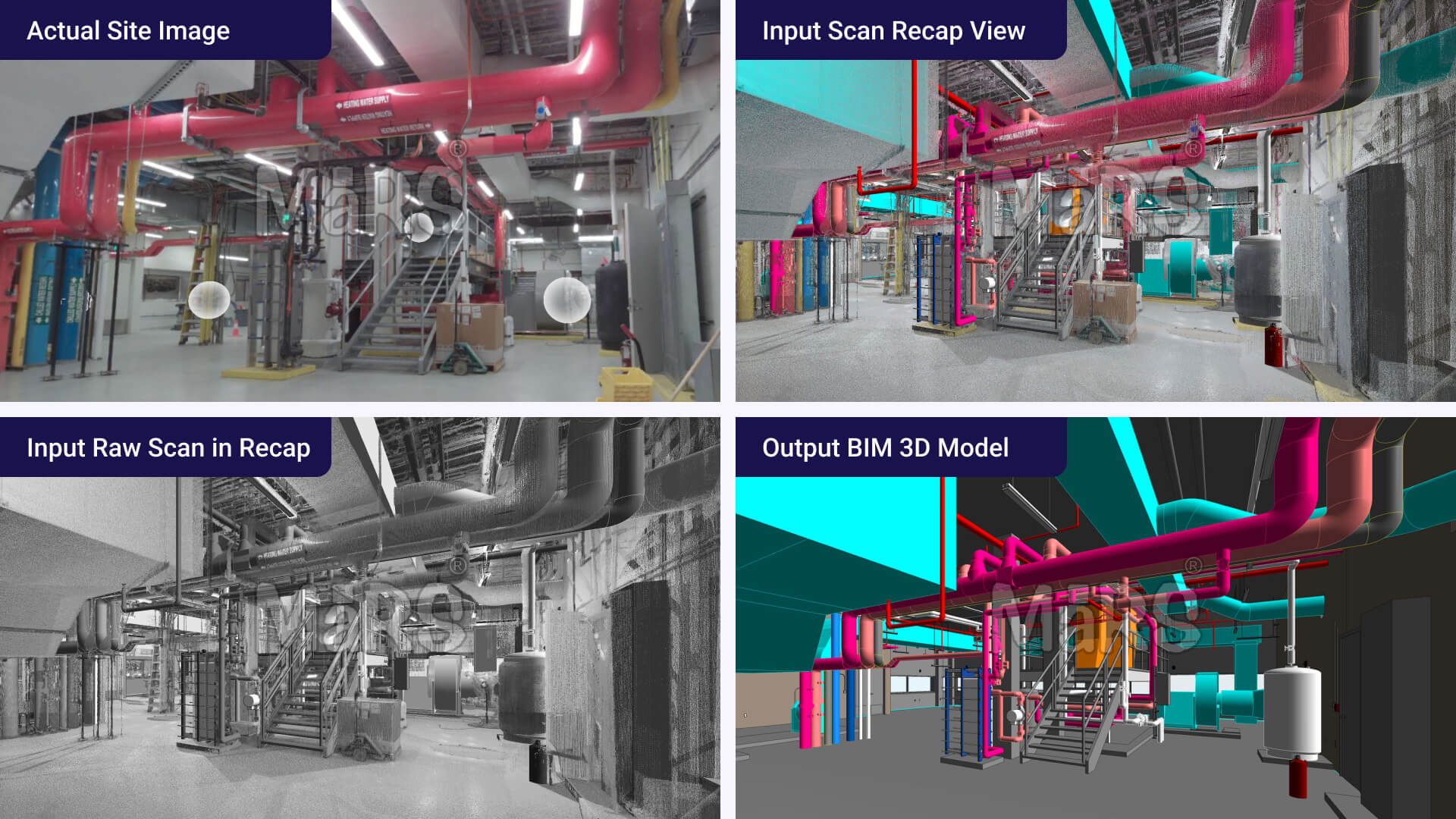
A hospital renovation required MEP coordination in a tight ceiling space. The Scan to BIM model helped avoid pipe clashes and reduced rework by 40%.
As more projects require Building Information Modeling, Scan to BIM is becoming a key part of starting any new design. It supports better planning, fewer delays, and smoother construction. This is why it is now a popular and trusted solution across many sectors.
Check out the Common Benefits of Scan to BIM.
Applications and Use Cases of Scan to BIM
- Producing accurate as-built drawings from point cloud data
- Planning renovations without relying on outdated blueprints
- Modeling hidden MEP services based on ceiling and wall scans
- Performing clash detection between structure and new systems
- Creating detailed floor plans, sections, and elevations
- Generating room schedules and area calculations for compliance
- Validating construction progress by comparing scans to design
- Supporting prefabrication by modeling real-world pipe routes and dimensions
- Extracting quantities and material take-offs from 3D models
- Documenting heritage buildings for digital archiving and restoration
- Planning fire safety upgrades using existing layout models
- Creating COBie-ready models for facility management systems
- Supporting space management in hospitals, schools, retails, and offices
- Aligning new design models with georeferenced point clouds
- Producing 2D CAD files, shop drawings, and IFC exports for contractors
- Identifying deviations in site conditions before retrofit or expansion
- Assisting in change order verification during construction
Software used in Scan to BIM
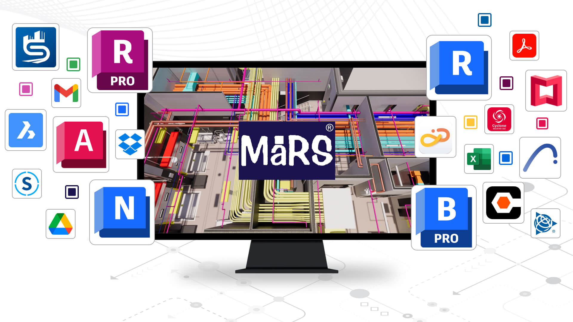
Scan to BIM requires a mix of software for scanning, processing, and modeling. Scanning software like FARO Scene, Leica Cyclone, and Trimble RealWorks handles the raw laser scan data. These tools align multiple scans, remove noise, and export the final registered point cloud.
After processing, the point cloud is imported into BIM software. Autodesk Revit is the most commonly used platform for creating detailed 3D models. Other tools like AutoCAD, BricsCAD BIM, or Archicad may also be used depending on project needs.
For coordination and review, tools like Navisworks help run clash detection and QA. Some teams also use Recap Pro to clean and prepare point clouds before modeling. The combination of these tools ensures the final BIM model is accurate, usable, and ready for design or construction.
Getting Started with Professional Services
Working with a Scan to BIM service provider makes the process smooth and reliable. When you hire a professional team, they guide you through every step. First, they understand your project goals, site conditions, and required deliverables. Then, they help plan the scanning scope, locations, and tolerance levels.
You will receive a schedule and project workflow. This includes site scanning, point cloud registration, modeling, quality checks, and delivery. The provider also explains the LOD (Level of Detail) you need based on your use case such as renovation, clash detection, or facility management.
You can expect updates throughout the process. Good communication ensures you know what’s happening at each stage. The final delivery includes your BIM model and any required 2D drawings or reports.
Why Choose a Professional Service Provider?
Professional Scan to BIM providers bring experience, precision, and project control. Their teams work with advanced laser scanning tools and modeling software. They understand scanning standards, BIM workflows, and the technical details behind model creation.
Key benefits include:
- Experienced Teams – Skilled in complex building types, industrial sites, and renovation projects.
- QA/QC Processes – Every model goes through a quality check to ensure accuracy and consistency.
- Software Knowledge – Experts use tools like Revit, ReCap, Navisworks, and BIM 360.
- Timely Delivery – Projects follow a clear schedule with milestones and deadlines.
Pro Tip
Ask for section cuts or snapshots during modeling. It helps ensure the model matches site conditions before final delivery.
You save time and avoid errors by working with a team that does this every day.
Why work with MaRS on your project?
MaRS BIM Solutions delivers Scan to BIM models that meet high accuracy standards. We understand the needs of architects, engineers, and contractors. Our team has handled projects across commercial, residential, industrial, and infrastructure sectors.
Here’s what sets MaRS apart:
- Accurate Models – We model based on clean point cloud data with defined tolerances.
- Clear Communication – You receive updates, previews, and feedback points throughout the project.
- Experienced Team – Our team understands site conditions, modeling standards, and BIM coordination.
- Flexible Delivery – We provide Revit models, IFC files, CAD drawings, and more based on your needs.
We act as your technical partner, not just a vendor.
Our Experience with Scan to BIM Projects
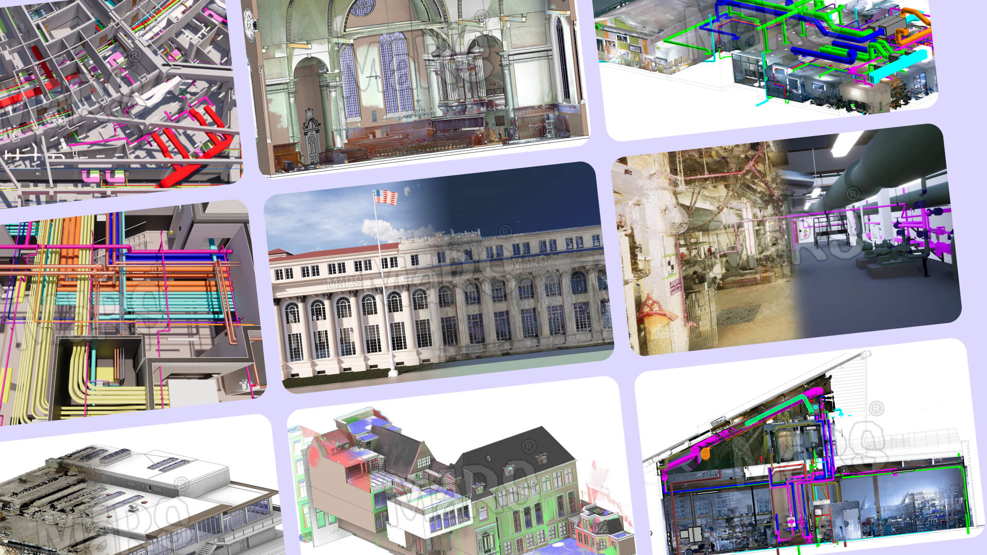
MaRS BIM Solutions has worked on diverse projects where accuracy and fast delivery were critical. From dense mechanical rooms to complex heritage facades, our team has handled varied building types and modeling scopes.
We support general contractors, architects, survey companies, and MEP consultants. Each project is handled by a skilled team trained in laser scanning workflows, point cloud processing, and Revit modeling. We’ve delivered models for both ongoing construction and existing buildings, supporting clients through every project stage.
Our past work includes:
- Interior fit-out models for retail chains
- MEP coordination for hospital renovations
- Heritage building documentation for record and restoration
- Utility mapping and pipe modeling for plants and warehouses
- Clash detection models for airport terminal upgrades
- Office buildings scanned for renovation and interior design
- Retail stores modeled for layout planning and fixture installation
We deliver models that support design, coordination, and renovation planning with precision.
Partner With MaRS for Your Next Scan to BIM Project
If you need accurate as-built models, MaRS is ready to support your next project. We work with construction firms, survey companies, and design teams across the USA and beyond. Use the free consultation to understand what LOD you need. It helps save both time and cost. Whether you need a basic LOD 200 model or a full LOD 400 coordination file, we can help.
We start with your goals and deliver a model you can rely on. Let’s simplify your BIM workflow and reduce site errors with accurate, verified data.
Book a Free Consultation
Ready to get started? Contact MaRS BIM Solutions for a free consultation. We’ll review your project, answer your questions, and recommend the right Scan to BIM approach.
Reach out at [email protected] to schedule a 30-minute introductory meeting.