The construction sector has seen changes shift from an ineffective process to a well-organized, streamlined, and dependable one. This transformation has mainly been fueled by the introduction of Building Information Modeling (BIM) technology and digitized construction procedures. These innovations have made infrastructure construction and refurbishment simpler, offering advantages to the AEC sector. An important benefit of BIM technology is its integration of photogrammetry and laser scanning into the workflow.
Moreover, the implementation of Point Cloud to BIM technology has transformed the AEC industry. This method involves converting point clouds obtained through laser scanning into 3D models that represent the area on the screen. Point Cloud to Revit Modeling Services is frequently used for renovation, restoration, and infrastructure redevelopment projects, demonstrating the industry’s progress. This article, in the following sections, will discuss in detail the Point Cloud to Revit Modeling process, its importance, and its benefits.
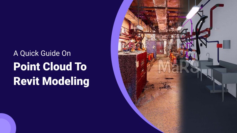
Point Cloud: What Is It and How Does BIM Use It?
Point clouds are distance measurements taken with laser scanners, drones, or sensors. The cloud of points is the photographic data for each of these spots, as well as the gathering and organization of all the spatial scenarios and investigations made by the receiving device. A 3D model can be developed using the point cloud data. The scanned data aids in building and facility management by enabling detailed information collection and the creation of a BIM-style schematic.
This process enables the conversion of 3D physical space into digital format and expands the current digital model. It can be used for measurement and control of objects, 3D printing, visual visualization of remote locations, image recognition, automated analysis, reconstruction, and operation, and the creation of mathematical and three-dimensional models.

The need for Point Cloud to 3D Revit Modeling
By transforming data into 3D models like BIM, Point Cloud technology has completely changed the AEC sector. To generate a 3D BIM model, the procedure entails compiling and presenting Point Clouds of a place, structure, or surroundings. The point cloud data, which becomes a mesh for an accurate and detailed 3D model, illustrates the data from laser scanners. Using the meshes, comprehensive BIM models that show how components join together during construction are created.
As-built drawings, MEP Collaboration, remodeling, design verification, design assessment, quantity takeoffs, and cost estimates are among the applications for which the Point Cloud to Revit model is useful.
Process of converting Point Clouds to 3D Revit Modeling

Point cloud data conversion to 3D Revit modeling is known as Scan to BIM or Point cloud-to-BIM. The procedure involves the following steps to guarantee the delivery of efficient models:
1. Data Capture
3D laser scanning or photogrammetry is utilized to obtain the point cloud data. This aids in compiling all of the project’s field data. A comprehensive scope of work, level of detail, schedule, and project deadlines are established at this point.
2. Importing Data
The acquired data is put into a point cloud tool to evaluate its quality. Following data processing and cleaning, each coordinate’s integrity is verified. To maintain fluidity and avoid disruptions from vibrations in the surrounding environment, survey data validation is essential.
3. Enhancing the Data
Unwanted object data from 3D point clouds can be eliminated using programs like ReCap. While exporting the scan to Revit, accurate surface optimization is made easier by eliminating both internal and external noise from the geometry processing phase.
4. Exporting the Data to Revit
Using software tools, the point cloud data is transformed into a format that is compatible with Revit. RCS and LAS are examples of common formats. After undergoing conversion, point cloud data can be imported into the software. In Revit, users can further enhance and detail the resulting 3D model of the building or structure.
5. Revit Modeling
After the point cloud has been imported, 3D model elements can be created in Revit using tools like Model Line, Wall, or Floor. The Revit model needs to be regularly assessed and improved to ensure alignment and accuracy with the point cloud data.
Advantages of Point Cloud to Revit Modeling
1. Cost and Time Efficient
Utilizing point cloud modeling helps minimize mistakes and unforeseen expenses, enhancing the precision of project planning and time management, leading to allocation of resources.
2. Accurate Modeling
Point Cloud Modeling offers precise, fast three-dimensional modeling, whereas field-based LIDAR produces results with 1- to 30-centimeter precision, frequently with GPS integrated for accuracy.
3. Reduced Errors
By detecting possible design and construction problems early on and decreasing errors and dangers related to manual measurements, the scan-to-BIM process lowers costs and delays.
4. Preservation of Historic Buildings
Scan-to-BIM modeling is beneficial for historic preservation projects since it replicates and preserves historical information, minimizing obsolete or erroneous blueprints in older buildings.
Related blog:
Scan-to-BIM Introduction: From Technology To The BIM Model
Final Words
Point cloud to BIM is a productive way that offers quicker turnaround times and lower costs when digitizing and documenting building and infrastructure conditions. Point cloud to Revit 3D model conversion enables customized scan-to-BIM techniques to solve project obstacles.