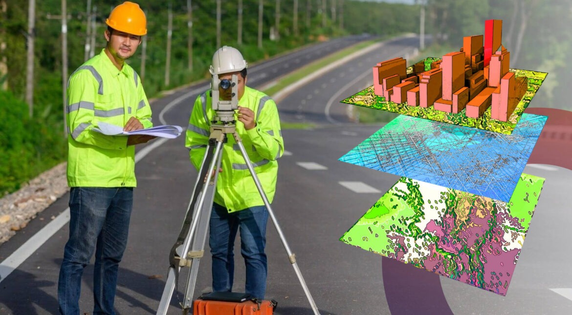
The contemporary urban environment is changing dramatically. Cities are becoming smarter due to increased sustainability consciousness and technological breakthroughs. Through data and technology, these smart cities become more productive and can better maximize resource utilization, eventually giving their residents a better standard of living. Geospatial engineering services can be rightfully called the main drivers of the above-mentioned revolutionary process, and they are quite effective tools.
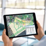
Geospatial engineering services are indispensable to the smart city, which is the development of integrated solutions and decision-making across multiple sectors. Such a component brings considerable additions that are utilized in various spheres of city governance. They fulfill this by providing a set of tools that can collect, analyze, and broadcast spatial data. In Geospatical Engineering scan to 3D Modeling services play a vital role. This article will holistically explore the elements of geotechnical application, whether transfiguration or bringing out the concept of smart, sustainable, and functional urban spaces.
How do Geospatial Engineering Services aid Smart Cities?
One of the great strengths of spatial data engineering services in intelligent urban areas is the possibility of shaping raw data into critical pieces of information. Following are some ways:

Traffic and Resource Management:
City departments can employ geospatial tools in transport management and collect vehicle information and data from sensors. When this technology is used to better facilitate emergency management and identify high-traffic roads, then it allows us to use the data in order to change signal timings, give drivers alternative routes, and shorten travel times. As a result, emergency services could respond to emergencies faster.

Infrastructure Planning:
By studying travel patterns, population, and existing availability, land management can really sharpen the infrastructure. Through data-informed approaches, cities can lower costs and concerns with the environment during construction workflow processes, increase efficiency by detecting malfunctions prior to their occurrence, analyze the number of future residents to plan for their needs, and design infrastructure in particular locations that are ideal for innovation. Therefore, infrastructural projects will be more efficient when they have an anticipatory plan.
Public Safety:
Geospatial services provide first responders with the ability to gather multiple data types at their disposal when required, including weather, traffic, and crime data. The evacuation, identification, and utilization of spillways during emergency instances become more accessible and efficient with the presence of online data about accidents, fires, and infrastructure problems.
Citizen Engagement:
Monitoring the data with the help of an endless amount of software facilitates public participation in smart cities by means of geospatial engineering services. Geospatial data visualization builds a social platform driven by trust and cooperation because it makes communication between local government representatives and residents healthy.
Challenges and Concerns
Even though there is a lot of potential for smart cities with geospatial engineering services, these are the challenges they face:
Data Privacy and Security: Gathering vast amounts of geographical information may compromise privacy. It’s, therefore, essential to protect people’s trust and prevent misuse by adopting strong data anonymization measures and transparent regulations.
Data Interoperability: Many sensors and platforms come from different vendors when it comes to smart cities. For compatibility, standardized protocols need to be put in place for smooth operation through open data formats.
Data Accuracy and Maintenance: The correctness of conclusions drawn from geospatial data depends on the input’s precision. Dependable information is possible only through routine confirmation, preservation, and checks for quality.
Read also: How Geospatial Engineering Services Can Optimize Your Construction Workflow?
The Future of Geospatial Engineering Services in Smart Cities
The future of geospatial engineering services in smart cities is encouraging. These services have many potentialities that can be explored. Here’s what we can expect:
Artificial Intelligence (AI): AI will help us make better decisions based on predictive maintenance for infrastructure, real-time traffic congestion forecasting, and even crime pattern analysis, among others.
Internet of Things (IoT): A city may soon have millions upon millions of interconnected devices producing a constant stream of real-time data about every nook and cranny of its environment. This will demand quick process, hence, the need for Geospatial integration capability within systems analytics becomes more dynamic, leading to responsive operations towards smarter cities.
Big Data Analytics: Dealing with large amounts of information is what we call big data analytics and it is useful when working with spatial datasets that are collected in smart cities.
In the future of smart cities, CAD to BIM conversion services will streamline geospatial engineering by integrating CAD drawings into intelligent Building Information Models (BIM). This integration enhances collaboration and decision-making for sustainable infrastructure development.
Wrapping Up
Geospatial engineering services are not just a tool for smart cities; they are what make smart cities possible. By utilizing spatial data to drive new technologies, districts can be more effective, livable and sustainable in the coming days. This means that such issues should be viewed as opportunities rather than challenges because they open up new frontiers for creative applications and sustainable development through such things as AI (Artificial Intelligence), IoT (Internet of Things) or Big Data Analysis, which can help tap into geo-datasets stored in various formats, including textual form, among others so that people may understand their environment better.